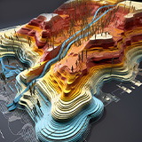
Drone Mapping Syllabus PDF: Learn Advanced Techniques
The Drone Mapping Syllabus PDF is a detailed guide for mastering advanced drone mapping techniques and geospatial technologies. This intensive 3-month program provides practical, hands-on training in:
- UAV Photogrammetry
- LiDAR
- GIS Software
- Terrain Mapping
- GPS-based Flight Planning
Designed to equip professionals with the skills needed to excel in industries like construction, environmental monitoring, and urban planning, this course emphasizes precision data acquisition and analysis.
From creating high-resolution maps to generating actionable insights, the curriculum ensures learners can produce professional-grade outputs that meet the demands of various industries.
Step-by-Step GIS Drone Course Structure PDF for Beginners
The drone course structure outlines a comprehensive framework for integrating drone data with Geospatial Information Systems (GIS).
The GIS Drone Course Structure PDF focuses on transforming raw UAV data into actionable insights through spatial analysis and visualization.
Participants will gain skills in managing, interpreting, and analyzing geographic data to support strategic planning and decision-making processes.
- The course structure includes training in data integration, sophisticated visualizations, and performing spatial analyses tailored to industries such as urban planning, environmental monitoring, and resource management.
- Mastery of these GIS applications positions learners as valuable assets in sectors that depend on geospatial intelligence for infrastructure development, sustainability projects, and land-use planning.
3D Modeling & Terrain Mapping
Another highlight of the course is training in 3D modeling and terrain mapping, where participants learn to create detailed visual representations of landscapes and structures.
This module teaches learners to transform drone-captured data into accurate 3D models using software like Pix4D and Agisoft Metashape.
These skills are indispensable in industries like construction and real estate, where clear insights into terrain and structural details drive project success.
From topographic mapping and volume calculations to virtual walkthroughs and simulations, the ability to generate and analyze 3D models enhances decision-making processes and ensures project efficiency.
GPS-Based Flight Planning for Large-Scale Surveys
Efficient flight planning is a critical skill for professionals conducting large-scale drone surveys.
- This module focuses on using GPS technology to plan optimized flight paths that maximize data collection efficiency.
- Participants will learn to account for factors such as battery life, terrain, and weather conditions, ensuring seamless operations.
- Whether assessing infrastructure, conducting environmental surveys, or mapping agricultural fields, this training ensures that projects are completed on time and within budget.
Remote Sensing Techniques for Environmental Monitoring
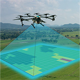
Remote sensing is a vital component of drone mapping, particularly for environmental and geological applications. This module explores the use of multispectral and thermal imaging sensors to capture data on vegetation health, surface temperatures, and water quality.
Participants will learn to process and analyze this data to detect environmental changes, support conservation efforts, and assess land use.
These capabilities are invaluable for projects like reforestation, mineral exploration, and climate change monitoring. By mastering these techniques, learners will contribute to sustainable development and ecosystem preservation initiatives.
Why Choose Drone Mapping & Geospatial Technologies Training?
- This course combines theoretical knowledge with practical expertise, providing a structured approach to mastering drone mapping and geospatial technologies.
- The focus on UAV photogrammetry, LiDAR, GIS, and remote sensing ensures participants gain versatile skills applicable across industries.
- At the end of the training, you will have access to the UAV Course Syllabus PDF, a comprehensive resource consolidating all modules for ongoing reference and professional development.
Dr. Arvind Kumar has over 15 years of experience in UAV technology and geospatial sciences. He specializes in integrating AI-driven automation in drone operations. As a DGCA-certified drone pilot, Dr. Kumar is passionate about sharing his knowledge with aspiring drone professionals, helping them excel in this transformative field.
Dr. Arvind Kumar
With over four years of diverse experience spanning technical and managerial domains, Chetna Sharma has consistently demonstrated leadership, innovation, and adept project management skills in alignment with DGCA guidelines. Her journey has been marked by a passion for driving technological advancements, particularly in the realm of unmanned aerial vehicles (UAVs) and drone manufacturing.
Chetna Sharma
Drone Mapping Careers in India: A Growing Opportunity
Drone mapping and geospatial technologies have revolutionized data collection and analysis, making it very simple to get career opportunities. Drone Mapping Careers in India are gaining momentum as industries like agriculture, construction, and environmental conservation increasingly rely on UAVs (Unmanned Aerial Vehicles) for accurate geospatial intelligence.
This course in Drone Mapping & Geospatial Technologies equips you with practical knowledge of:
- UAV photogrammetry
- LiDAR
- GIS software
- 3D terrain modeling
By mastering these advanced tools, you can contribute to projects that demand precision, efficiency, and innovation.
From creating detailed maps for urban planning to analyzing land use for sustainable development, this field offers a dynamic career pathway.
Drone mapping professionals play a critical role in ensuring the success of large-scale projects, offering the technical expertise needed to collect, process, and interpret data that shapes modern industries.
Top Industries Offering Geospatial Drone Opportunities in India
The rising demand for geospatial intelligence has unlocked numerous Geospatial Drone Opportunities in India across a variety of industries.
Graduates can work in:
- Urban Planning
- Land Management
- Construction Surveying
- Infrastructure Monitoring
This course prepares you to handle large-scale projects requiring accurate GIS data and 3D terrain models.
Geospatial professionals trained in drone mapping are indispensable in tasks such as creating digital elevation models, monitoring infrastructure, and assessing environmental changes.
These roles are especially critical in urban development projects, where the integration of accurate geospatial data supports efficient planning and resource management.
Advanced training in drone mapping allows you to work with cutting-edge tools like Pix4D, Agisoft Metashape, and other industry-standard software to process data into actionable insights.
As India continues to embrace drone technology for geospatial applications, skilled professionals will find themselves in high demand across sectors ranging from real estate to disaster management.
Top UAV Jobs in Land Management to Boost Your Career
The widespread adoption of drones in land management has opened countless “UAV Jobs in Land Management” offering exciting opportunities for professionals trained in geospatial technologies.
These roles involve using drones to optimize land use, monitor natural resources, and conduct topographic surveys essential for planning and development.
Professionals in this field are critical for industries like:
- Forestry
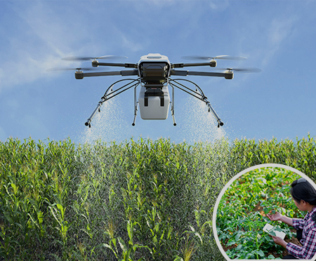
- Agriculture
- Environmental Conservation.
They provide detailed data to support land-use decisions that balance economic development with sustainability.
From mapping terrains to identifying areas for reforestation, UAV experts ensure that land management practices are both effective and environmentally responsible.
Completing this course not only equips you with the technical skills needed for geospatial applications but also positions you as a key contributor to India’s development initiatives.


